Tile calculator (a special purpose tool)
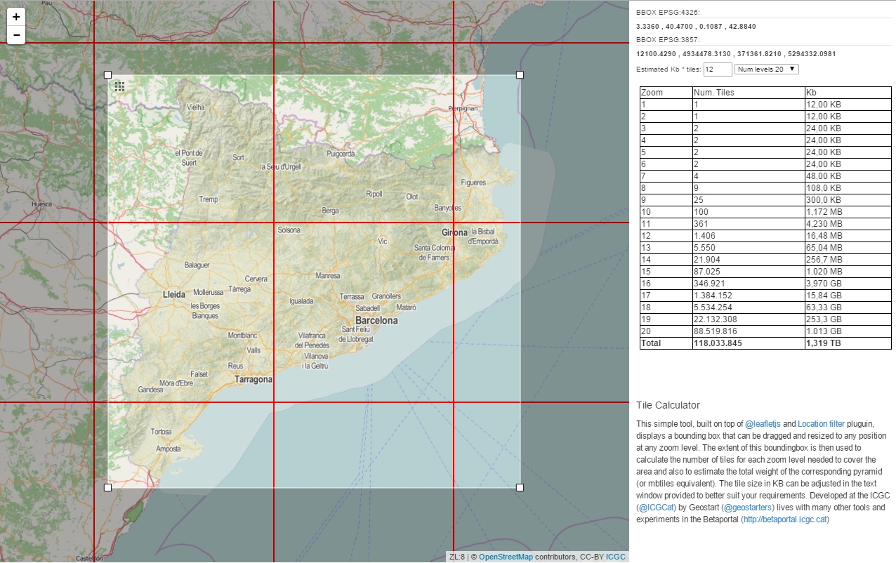 |
NAME: Tile calculator DESCRIPTION: Tile calculator is a tool to calculate the number of tiles inside a bounding box and estimate the weight of the corresponding pyramid. URL: https://betaserver.icgc.cat/visor/calculator.html |
Today we present you a very simple tool for technicians: Tile Calculator.
Maps in a browser are displayed by seamlessly joining dozens of individually image files over the internet. Each time the user pans or zooms the map, a new set of tiles are loaded and displayed in the browser. Tiles can be raster images (.png,. jpg) or lately vector tiles (.geojson, .pbf).
These map tiles are organized into a pyramid by their level of detail (zoom level). At zoom level 0 the entire world is just one tile, at zoom level 18 you can see street detail using millions of tiles.
These pyramids are usually stored as a SQLite database or .mbtiles file format. Mbtiles are becoming a powerfull format which allows the users to store huge amounts of map areas to consume them offline on mobile devices.
Tile calculator displays a bounding box that can be dragged and resized to any position at any zoom level. The extent of this boundingbox is then used to calculate the number of tiles for each zoom level needed to cover the area and also to estimate the total weight of the corresponding pyramid (or mbtiles equivalent). The tile size in KB can be adjusted in the text window provided to better suit your requirements.
Tile calculator is built on top of @leafletjs and Location filter pluguin.
Developed at the ICGC (@ICGCat) by Geostart (@geostarters) it lives with many other tools and experiments at Betaportal (https://betaportal.icgc.cat, betaportal@icgc.cat)